Hartwood, Virginia
Unincorporated community in Virginia, United States
38°24′8″N 77°33′55″W / 38.40222°N 77.56528°W / 38.40222; -77.5652822471[1]
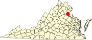
Hartwood is an unincorporated community in Stafford County in the Commonwealth of Virginia, a U.S. state.[2] Hartwood is located fifteen miles northwest of Fredericksburg.[citation needed]
The former Hartwood Airport is located near the community.
History
A post office called Hartwood has been in operation since 1832.[3] The district was named from the hart seen by settlers in the woods.[4]
Hartwood Manor and Hartwood Presbyterian Church are listed on the National Register of Historic Places.[5]
References
- ^ "Hartwood ZIP Code". zipdatamaps.com. 2022. Retrieved November 30, 2022.
- ^ Dodd, Anita L.; Lee, M. Amanda (2007). Stafford County. Arcadia Publishing. p. ix. ISBN 9780738544106.
- ^ "Stafford County". Jim Forte Postal History. Retrieved May 3, 2015.
- ^ Dyson, Cathy (July 20, 2003). "History and legend unlock origins of unusual names". The Free Lance-Star. pp. A7. Retrieved May 3, 2015.
- ^ "National Register Information System". National Register of Historic Places. National Park Service. July 9, 2010.
- v
- t
- e
Municipalities and communities of Stafford County, Virginia, United States
County seat: Stafford
- Aquia Harbour
- Boswell's Corner
- Camp Barrett
- Falmouth
- Quantico Base‡
- Southern Gateway
- Stafford
communities
- Aquia
- Argyle Heights
- Arkendale
- Bel Air
- Berea
- Brooke
- Brookfield
- Chatham Heights
- Cropp
- Daffan
- Ferry Farm
- Garrisonville
- Glendie
- Grafton Village
- Hartwood
- Heflin
- Holly Corner
- Leeland
- Little Falls
- Midway Island
- Ramoth
- Roseville
- Ruby
- Shiloh
- Spring Valley
- Storck
- Sullivan
- Tacketts Mill
- Tylerton
- White Oak
- Widewater
- Widewater Beach
‡This populated place also has portions in an adjacent county or counties
- Virginia portal
- United States portal
 | This Stafford County, Virginia state location article is a stub. You can help Wikipedia by expanding it. |
- v
- t
- e


